MoorWissen Summary - Facts about Peatlands
Formation and Distribution
Formation: Peatlands exist where a high groundwater table limits the decomposition of organic material. Thus, production of organic matter is higher than decomposition, resulting in the formation of peat [1]. In Central Europe, peatlands began forming ca. 10,000 years ago, when the glaciers melted after the last glacial period. The water which was formerly bound in the glaciers now lifted the groundwater table and peatlands developed. In near-natural peatland sites peat formation is still continuing.
Even though mineralization is limited by high ground water tables, only 2-16% of fresh organic material is transformed into peat while the rest is mineralized. Therfore, mires on average form a 0.5mm layer of peat per year. Under optimal conditions quantities of up to 1mm can be reached [3,5].
Distribution: Peatlands cover only roughly 3% of the global land surface, but contain roughly 20% of the total carbon stored in all terrestrial ecosystems. Thus, peatlands are the most space-effective carbon stocks of all terrestrial ecosystems [7].
Proportional the total size of the country, Finland was the country with highest amount of areas covered with peat worldwide. Roughly one third of Finland's territory was originally covered with peat. The Wasjugan peatland (Siberia) is considered to be the biggest peatland in the world. It covers more than 5 millions hectares, which is roughly four times the size of the German federal state Schleswig-Holstein [6]. Initially mires covered 4-5% of Germanys land surface (estimates vary between 1.4 and 1.8 million ha). Due to drainage and subsequent use currently only 25,000 ha can be classified mires, i.e. peat accumulating systems (2% of the former mire area) [4].
Threats
Agriculture is the main driver for global mire losses (50%), followed by forestry (30%). In contrast to what is often thought, peat extraction (mainly for fertiliser, substrate, energy, chemistry, and bedding) is responsible for “only” 10% of these losses. The remaining 10% of peatland losses can be attributed to urbanization and infrastructure development.
Drainage of peatlands changes their function from a CO2 sink to a CO2 source.
Drained peatlands in Germany used for potato cultivation emit equivalent to 37t CO2 per hectare per year. This amount equals a ride of 185,000 km in a medium-sized car. Drainage causes fundamental changes in peat chemistry and physics. Various processes cause subsidence (loss of height) of 1-2cm per year in middle latitudes. In Southeast Asia values of up to 7cm per year can be reached. In England, a peatland north of Cambridge has subsided 4m since 1848 [5,7].
Historical Development
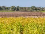
Because of their site characteristics ("too wet to drive, too dry to swim“) peatlands were the last areas to experience intensive use. Nevertheless, archaeological studies have revealed that peatlands were already used for hunting and gathering during the Stone Age [5,7].
Earliest human interventions in peatland ecosystems often had a positive effect on peatlands. Forest clearings increased the groundwater recharge which led to peatland expansions in many areas [2]. The first small-scale drainage of peatlands in Northern Germany took place in the 13th century. Cistercian monks used the drained areas to cut fodder and gather litter once a year [5,7].
Livestock grazing is common in near-natural as well as drained peatlands for millennia. Livestock can serve as natural landscape managers, but with increasing stocking density detrimental effects may prevail. Peatlands were also used for fodder and litter production, and in some countries this continues even today. Especially in boreal countries, fens were the most important areas for hay production. After cessation of traditional extensive mowing, competitive species like reed or alder often encroached on the former open, species rich areas.
First Steps into Peatlands and ...
... Research
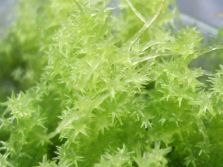
In addition to basic research, the scientific work at the Greifswald Mire Center focuses on paludiculture, which means using wet peat soils for agriculture or forestry. In this context, peat moss (Sphagnum) farming on raised bog sites has been a focus for several years. Cultivating crops on rewetted fens is also studied, for examples through the cultivation of cattail, reeds and other plants.
...Praxis
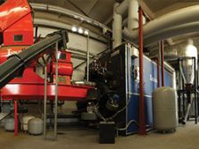
The GMC is working with various partners to develop pilots projects for the sustainable use of rewetted peatland sites and to shape the political framework for this transformation. These practical examples show both what the cultivation of crops on wet peat soils (paludiculture) can look like, and what possibilities there are for the utilisation of paludiculture raw materials.
...Politics
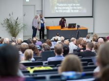
Peatland ecosystems can help us face the current ecological crisis - these systems must be used wisely. Wet and rewetted peatlands can contribute to climate and species protection both locally and globally. This requires the right political conditions and economic incentives at the national and European level. The GMC advises policymakers and regularly prepares current position papers and factsheets, which are available on the Greifswald Mire Centre website.
Further Information & Sources
- Dierssen K, Dierssen B (2001): Moore. Verlag Eugen Ulmer, Stuttgart.
- Ellenberg H, Leuschner C (2010): Vegetation Mitteleuropas mit den Alpen.
Verlag Eugen Ulmer Stuttgart. - Göttlich K (eds.) (1990): Moor- und Torfkunde. Schweizerbart Science Publisher, Stuttgart.
- Joosten H, Tanneberger F, Moen A (eds.) (2017): Mires and peatlands of Europe.
Schweizerbart Science Publisher, Stuttgart. - Succow M, Joosten H (eds.) (2001): Landschaftsökologische Moorkunde.
Schweizerbart Science Publisher, Stuttgart. - Tanneberger F, Hahne W, Joosten H (2003): Wohin auch das Auge blicket:
Moore, Moorforschung und Moorschutz in Westsibirien. Telma 33: 209-229. - Wichtmann W, Schröder C, Joosten H (eds.) (2016): Paludikultur –
Bewirtschaftung nasser Moore. Schweizerbart Science Publisher, Stuttgart.


